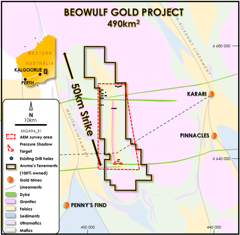
The Beowulf Gold Project was pegged in 2017, and the project covers 490kmof highly gold prospective greenstone sediments. In early September 2017, prospectors operating in the centre of the project area approached the Company with the possibility of a joint venture or sale of four granted single graticule ELs. These ELs have been successfully mined for surface nuggets since 2006 over an area of two parallel zones measuring in excess of two kilometres in length.

Remote geophysical data from Geoscience Australia identified the possibility of greenstone belts (mafic and sedimentary units) in the area, rather than what had previously been interpreted as granites. The Beowulf leases were pegged on this basis, and initial field work confirmed the rocks as greenstone belts – with eluvial gold workings already over the area.

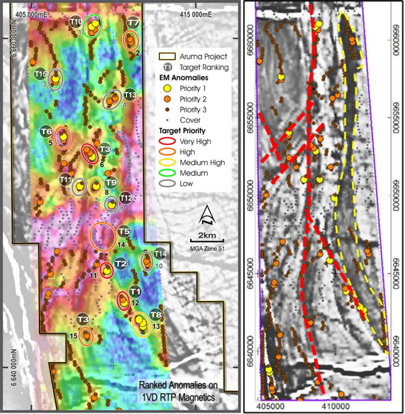
Aruma’s assessment of the Beowulf Project has resulted in it being ranked as one of the Company’s core, prospective gold exploration assets. As part of the systematic interrogation of the Project area, a major AEM Survey was also flown over the Project in late 2018 (as the same time as the Slate Dam AEM Survey).

Beowulf AEM Survey

The results of the AEM Survey at the Beowulf Project were highly positive and, in conjunction with low level magnetics and commercially available gravity, were plotted with the results of a gold soil sampling program in order to define priority drill targets.

Image module

Beowulf Gold Project location map, with interpreted geology and existing gold deposits.

Image module

Ranked anomalies at Beowulf Project shown on 1VD RTP Magnetics with lease boundary  (left) and Structures (right) with the magnetic low to the east similar to the Carosue gold deposit

The key points shown in the interpreted anomalies, as shown in the images above, are:-

  • Airborne EM targets sorted and ranked on structure and gold geochemistry
  • Significant north south structure (Avoca Fault extension) shown in red with conductors
  • Magnetic low, possibly representing Pig Well or Mt Belches (fold axis) in eastern part of survey area shown as the yellow shape
  • Northwest faults cross cutting the southern part of magnetic low (sediments) with conductors
  • Geological setting analogous to the Kilkenny Structure at the Carosue gold mine (Figure 1)

The high priority Beowulf drill targets are outlined below.

Image module

Beowulf Gold Project – Drill targets derived from AEM program