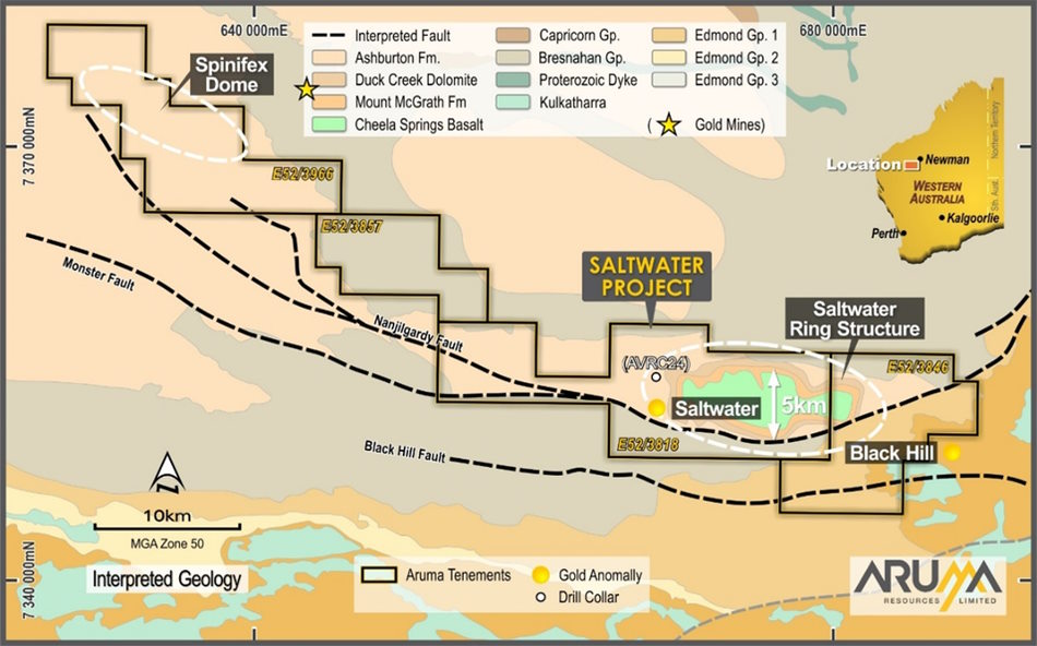
The Project area covers a strike extent of more than 65km of the highly significant Nanjilgardy fault, the same regional structure reported as the primary source of gold mineralisation at Northern Star Resources’ (ASX: NST) Paulsens Gold Mine and the Mt Olympus Gold Mine in the region.
The location of Aruma’s Saltwater Project area on 1:500,000 geology
The original geological mapping identified only Ashburton Formation (above), but re-interpretation from mapping outcrop and magnetics (below) suggested that there was Duck Creek Dolomite, Mt McGrath and Cheela Springs Basalt underneath and domed-up through the Ashburton Formation.
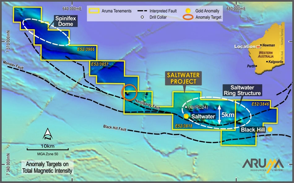
Aruma’s Saltwater Project area on TMI magnetics showing faults and anomalies – drill target area outlined in red and the new Spinifex Dome in white below.
EM data has resulted in the definition of the Spinifex Dome on the North-western area of the Project in E52/3966 (below). This new area is similar to the Saltwater domal structure contains the gold anomalies and is the same stratigraphy as Mt Olympus to the west.
Saltwater Project northwest area on EM – Spinifex Dome shown on the new lease E52/3966
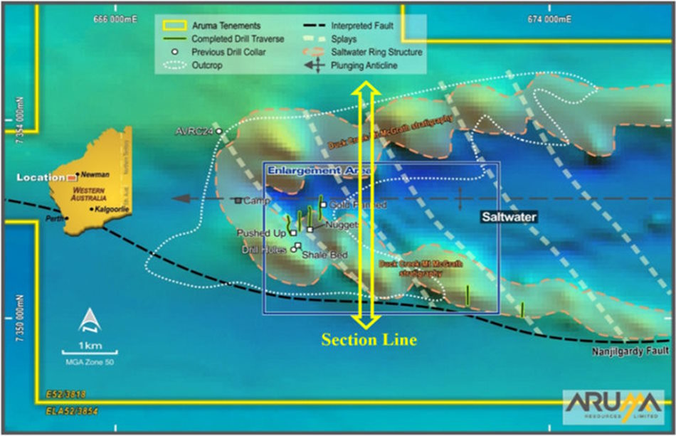
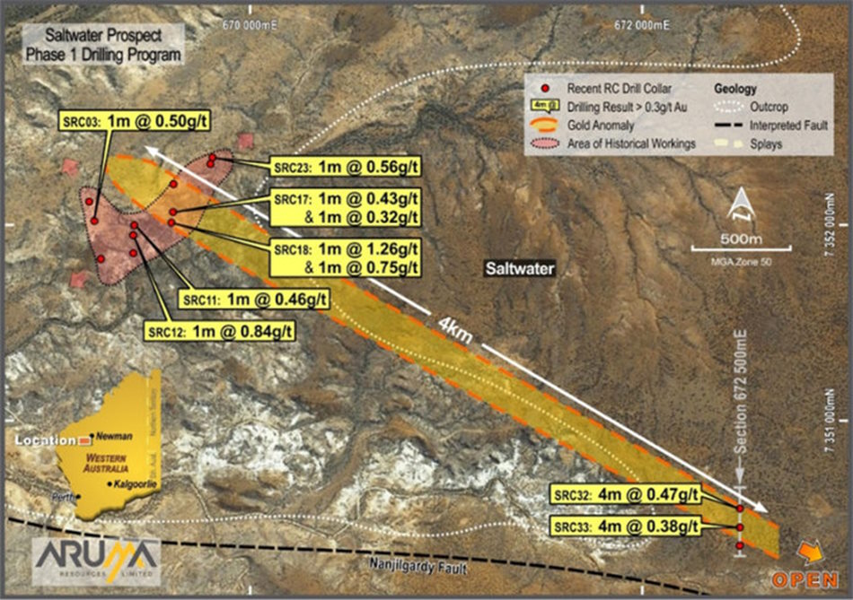
Drill program locations at the Saltwater project
The TMI magnetics are shown above, with the target Duck Creek-Mt McGrath stratigraphy as the shaded anticline.
Drilling targets to hit splays in the fertile Mt McGrath formation.
Aruma has completed two programs for 60 holes and 6,597m reverse circulation (RC) drilling at the Saltwater Gold Project in December 2020 and November 2021.
The drilling program focused on outcropping areas on the western end of the Saltwater Ring Structure, a large 60km2 magnetic ring structure that sits within E52/3818 at Saltwater. Drilling was conducted over four short, closer-spaced lines which targeted the anomalous western area of the Saltwater Ring Structure and wider spaced (regional) longer lines, to the east.
The drilling results of anomalous drill results >0.1g/t – showing cluster on the historic area (top left) and the projected extension to the East Line (bottom right)
Intersections grading up to 1.26g/t gold were received from drilling at the historic Saltwater mining area. The results were viewed as being highly encouraging and extended over a strike length of 4km and indicated the discovery of a possible new gold camp at Saltwater.
Significant intersections >0.3g/t from the 60 hole program
The close-spaced drilling targeted old workings at the historic Saltwater mining area within the recently identified and prospective Mt McGrath Formation, which hosts Mt Olympus Gold Mine.
The wider-spaced drilling targeted the extension of the contact and structure under cover some 3km east.
PLANNED EXPLORATION
Following the definition of a new structurally controlled domain, Aruma plans to use detailed magnetics and conductivity surveys to target zones capable of hosting economic gold deposits. These will be located on splays off the Nanjilgardy Fault, similar to both Paulsens (Hardy Fault) and Mt Olympus (Zoe Fault).
Aruma relinquished some 40% of the leases in 2022 after the lower results from the second round of RC drilling but kept the core leases over the Nanjilgardy fault and Spinifex and Saltwater Domes.
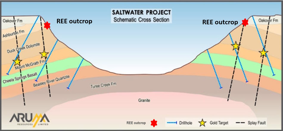
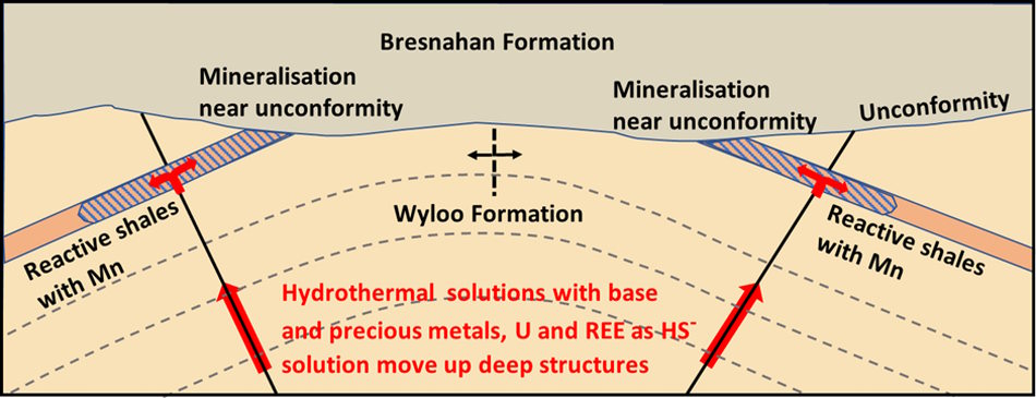
Stratigraphy and Mn Shale target stratigraphy which correlates to the gold targets in the cross section above.
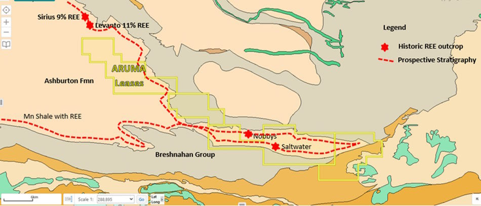
The renewed interest in Rare Earth Elements (REE) has seen the area pegged by Dreadnought Resources Limited (DRE) and Aruma will be following up the prospective shales in the lease area shown as a red dashed line. The total linear target is over 60km long.
The interpreted model for the REE stratigraphic targets is shown below.
All the known outcropping anomalies fit this model.
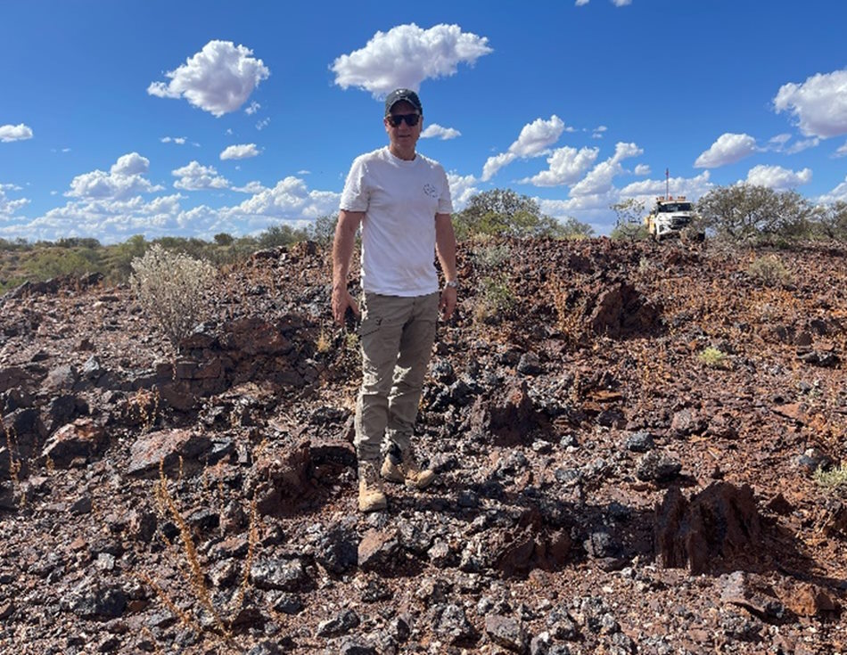
MD Glenn Grayson on the 11%REE outcrop at Levanto historic sample site
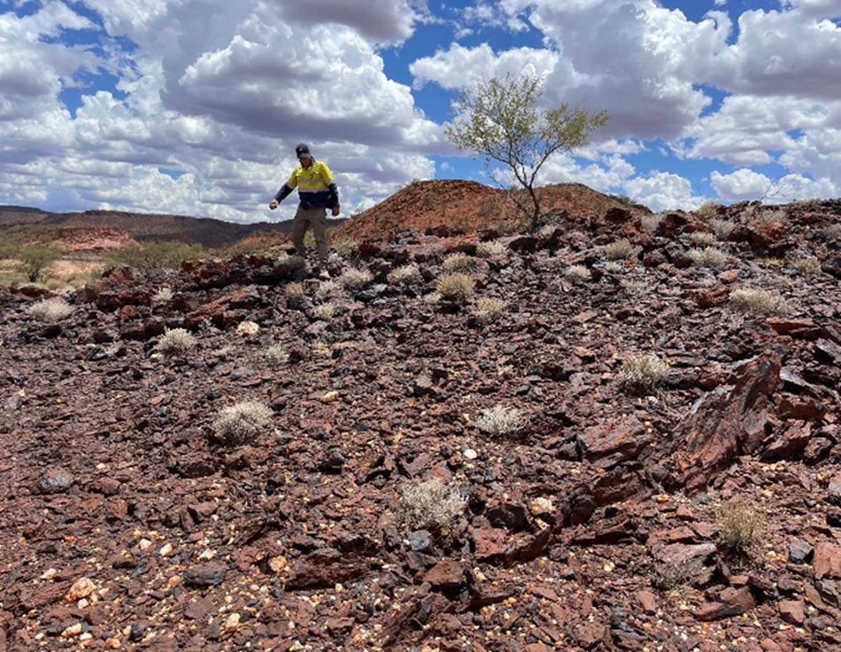
MD Glenn Grayson on the similar Fe rich shale in the Mt McGrath Formation at Saltwater